


Published on: 08/14/2025

Description
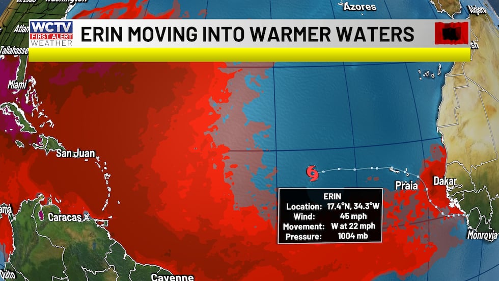
TALLAHASSEE, Fla. (WCTV) - On Monday, the National Hurricane Center designated Tropical Storm Erin in the eastern Atlantic.
Tracking Erin
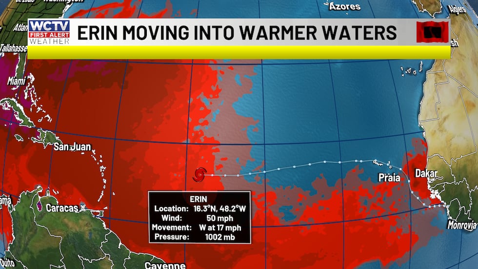
Erin is now located nearly 1000 miles east of the northern Leeward Islands and moving west at 17 miles per hour.
The tropical storm has winds of 50 mph and a pressure of 1004 mb. The National Hurricane Center is forecasting Erin to strengthen into a hurricane by Thursday.
The storm is now expected to strengthen rather quickly as it navigates through more favorable conditions for development.

Trouble developing so far
Key components to a tropical cyclone development are water temperatures at or above 80 degrees, low wind shear and absence of dry air.
During Erin’s early lifespan, the tropical cyclone struggled to strengthen because it lacked 80-degree waters.
The tropical storm was also ingesting Saharan dust. The aforenoted factors alone, lead to a slow development process for Erin.
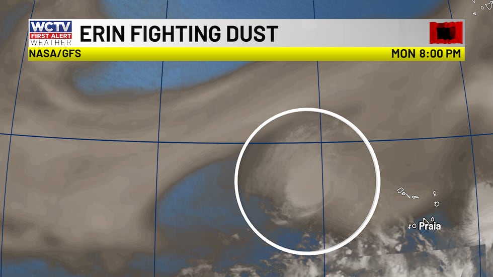
The dust also gave Erin a ragged look. Check out the satellite image from earlier this week.

Intensification is expected today
Thursday, Tropical Storm Erin is well into the 80-degree waters and not fighting as much dust in the Atlantic Basin. These factors should lead to pretty quick intensification over the next several days.
One reason meteorologists expect the curve north is the forecast of a stronger storm. Stronger tropical cyclones tend to turn northward earlier. Strong storms tap into the Coriolis force (spin from the Earth).
Weaker tropical storms are more likely to stay with the trade winds and continue on a more westward path.
The timing of the intensification is crucial to the eventual turn north. The earlier the storm strengthens, the earlier the turn.
But, that is NOT all...
Another part of the forecast is the steering pattern in the upper atmosphere. High pressure is currently parked over the Atlantic, this is the Bermuda High. This acts as a steering mechanism for tropical cyclones.
In Erin’s case, the Bermuda High is forecast to break down as an upper air trough digs into the Canadian Maritimes with an associated cold front. The front will introduce a path of least resistance for the tropical cyclone to funnel into.
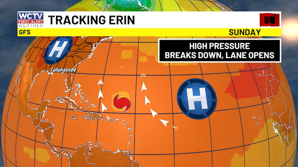
The combination of a strengthening storm and the cold front gives meteorologists some good confidence that Erin will curve out to the Atlantic and keep most of the significant risks off the United States coast.
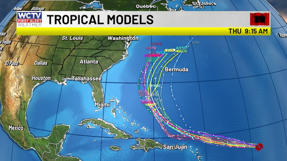
Spaghetti plots give a pretty good consensus that the curve north is likely. But in recent runs, there has been a slight shift west. Here are the recent runs of the tropical models:
There are still some risks with Erin, though, as the storm treks through the Atlantic. The tropical storm will still bring dangerous rip currents, waves to the Atlantic coast.
Changes to the forecast
There have been some subtle shifts in the forecast track over the last 24 hours, which include a later turn and a slight westward shift.
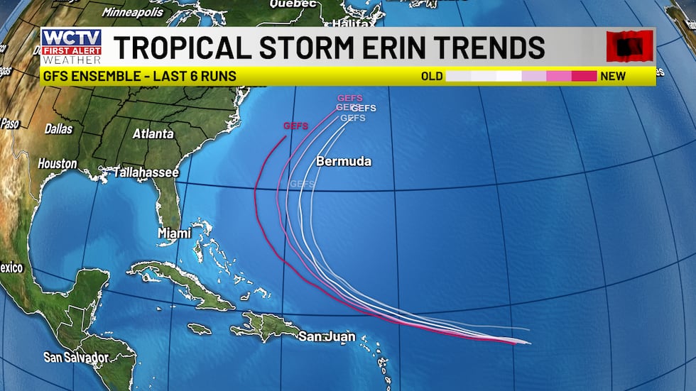
The shift brings impacts a little too close for comfort for the Outer Banks and Carolinas. Even with the latest shifts, there is still no threat to North Florida and South Georgia.
The hurricane hunters are on their way to Erin right now. Once the hunters get instruments into the tropical storm, data will help improve the forecast track going forward.
We have plenty of free tools to track tropical weather with us:
- The FREE WCTV Weather App
- Weather Articles and updates on the web
- First Alert Daily Weekdays at 2:00 p.m.
- First Alert Weather NOW for 24/7 access to WCTV’s weather
To stay updated on all the latest forecasts and weather, follow WCTV First Alert Weather on Facebook and X (Twitter).
Click here to see all the latest weather headlines and here to view the First Alert Radar. Receive push alerts and watch the latest forecast anytime on the free WCTV First Alert Weather app. Click here to download it now.
Interested in becoming a WCTV First Alert Weather Watcher? Click here to join the team!
Copyright 2025 WCTV. All rights reserved.
News Source : https://www.walb.com/2025/08/14/tropical-storm-erin-is-likely-intensify-thursday/
Other Related News
08/14/2025
DAMASCUS Ga WALB - On Thursday morning members of the Survival Flight Team honored a man w...
08/14/2025
WALB is working to produce a video for this story In the meantime we encourage you to watc...
08/14/2025
CRISP COUNTY Ga WALB - The Crisp County Sheriffs Office CCSO responded to complaints of dr...
08/14/2025
WALB is working to produce a video for this story In the meantime we encourage you to watc...
08/14/2025
HINESVILLE Ga WTOCGray News - The Army sergeant accused of injuring five people at Fort St...
Follow

Download Our App


Copyright 2022 © Albany Metro Community. All Rights Reserved