


Published on: 08/31/2026


Description
TONIGHT: Many stay dry as we head through the evening and overnight. Clouds will clear some overnight, temperatures settle in the low 70s. Some patchy fog is possible in the early morning.
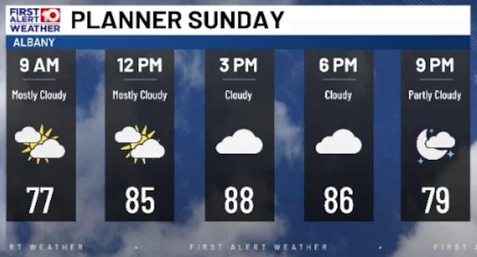
SUNDAY: Sunday looks warmer, highs reach to around 90°. Max heat indices will hit around 100°. It will still be cloudy, but a bit more sunshine is expected. Storm chances stay low at around 30%, mainly in the afternoon and early evening hours.
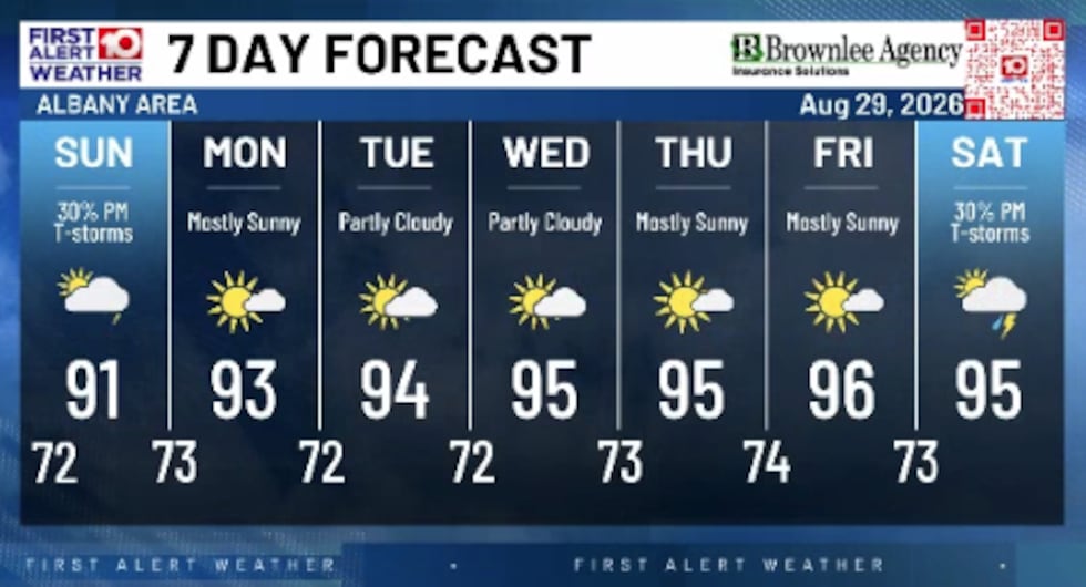
MONDAY - FRIDAY: A dome of high pressure, known for bringing hot temperatures and low rain chances, looks to settle back into the southeastern US. As a result, high temperatures will sit in the mid 90s and overnight lows in the low 70s through most of the week. The core of the high is to our north, meaning we could have a few showers and storms end up popping in SGA daily. Rain chances are low, but not zero, at around 20%, with slightly better chances closer to the FL-GA border.
Main takeaways are: no day is a washout, each day could see isolated showers and storms, and temperatures look to be above average.
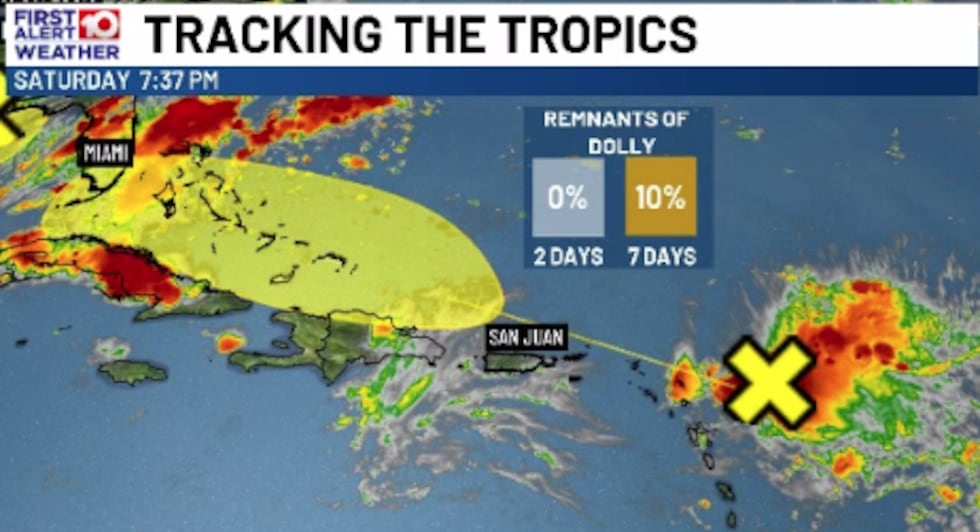
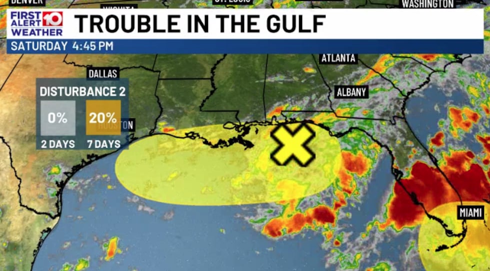
TROPICS: There are two areas of interest in the Atlantic currently: Remnants of “Dolly” and Disturbance 2, both of which could impact the US in some way this week. Impacts will be very minimal, here are the details.
- Remnants of “Dolly”: Has a 10% chance to redevelop within the next 7 days as it scrapes just to the north of the Lesser Antilles this upcoming week. Heavy rain and gusty winds will be possible for portions of the Lesser and Greater Antilles this week. Rain from this system could reach the Bahamas and south Florida by midweek, significant impacts are not expected at this time.
- Disturbance 2: Has a 20% chance to develop within the next 7 days in the northern Gulf. A few models have this system potentially organizing into a Tropical Depression or Storm, but it seems unlikely at this point. Impacts from this system were felt today along the northern Gulf coast, and will likely continue to be felt. Showers and storms could bring heavy rainfall at least through Monday in Florida all the way to the Louisiana coast. If this system does manage to briefly develop, the next name on the list is Edouard.
To stay updated on all the latest forecasts and weather, follow WALB News 10 Weather on Facebook and X (Twitter).
Click here to see all the latest weather headlines and here to view the First Alert Radar. To keep up with all things South Georgia weather, click to download the WALB First Alert Weather app on the Apple App Store and the Google Play Store.
Copyright 2026 WALB. All rights reserved.
News Source : https://www.walb.com/2026/08/29/september-sizzle-late-summer-heat-wave/
Other Related News
08/31/2026
ALBANY Ga WALB Community leaders advocates policy experts and residents came together Sat...
08/31/2026
LEESBURG Ga WALB The Lee County Sheriffs Office along with other law enforcement officers...
08/31/2026
TALLAHASSEE Fla Florida AampM defeated Albany State 20-7 Saturday at Bragg Memorial Stadi...
08/31/2026
ALBANY Ga WALB Make sure to vote for all your South Georgia high school football favorite...
08/31/2026
ALBANY Ga WALB Bikers and motorcycle riders from throughout Southwest Georgia came togeth...

Follow

Download Our App


Copyright 2022 © Albany Metro Community. All Rights Reserved